At ORPAX, we offer the services of topographical and cadastral mapping. Three dimensional topographic mapping can be applied in the creation of comprehensive topographic maps needed for the specification of projection parameters, relief, plannimetric details and for contours of 'Z' values. A cadastral map replicates a comprehensive mapping register including detailed real property values of a selected area. These detail values would include dimensions, precise locations, geographical classifications of extensive properties and other individual land parcels.
Topographical mapping.. How it is done
A large percentage of Raster to Vector conversions in topographical mapping is done using CAD based software like Microstation or Auto CAD. Specific features of a topographical map including boundary lines, contour lines, vegetation, water areas and forest areas etc are digitized or captured using different layers in order to create the Vector formatted topographic mapping. On the other hand, a 3D topographical map is made through a process of assigning 'Z' values to the respective contours to produce the topographical 3D terrain based model.
Cadastral mapping .. How it is done
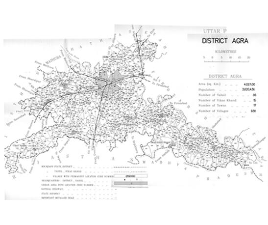
The production of cadastral mapping is a hard copy end product of the administrative maps. These maps have detail specifications of each plot of land, water bodies, railway lines, vegetations etc. The system is an effective tool to be used for management of various public land based records. Cadastral maps are also connected with a back end database that has all the details of the identified plot and its pertaining attributes. At ORPAX, we undertake all types of cadastral mapping projects including large scale mapping projects that necessitates scanning of various hard copy maps, geo referencing of each individual map, digitization of maps integrating proper layer structures, merging individual cadastral maps with single maps related to a particular area and many other related undertakings. The value of cadastral mapping is enhanced due to its associated benefits such as its ability to survey district names, issue certificates of title numbers, exclusive identification numbers for individual parcels, positions of existing sections, structures, lot numbers and respective areas, selection of boundary dimensions, references to earlier mapping and adjoining of contiguous street names etc.
Orpax Qualtra is your one stop shop for requesting all types of topographical and cadastral mapping works. Our work expertise in land administration work encompasses a broad based range of verticals which include:
- Topographical mapping
- Data overlays
- Cadastral parcel mapping
- Orthophoto imaging
- Land information systems
With us, you can be assured of receiving a top notch mapping and digitalization of vector data derived from raster maps and our services are optimally focused for successful scientific analyses and specific GIS applications. ORPAX, as your end to end GIS service provider has implemented additional consulting services including data implementation and services for commercially marketed off the shelf products which integrates a variety of business information and data related to your organizations.
With us you can be assured of utilizing the latest GIS innovations and we ensure providing our valued customers with a state of the art service complete with management excellence. Our products and services are optimized for smartness, agility and perfect alignment with your end expectations.
